
The Canet lo Roig City Council organizes routes so that visitors and townspeople can enjoy a unique experience in nature.
Here we present some:
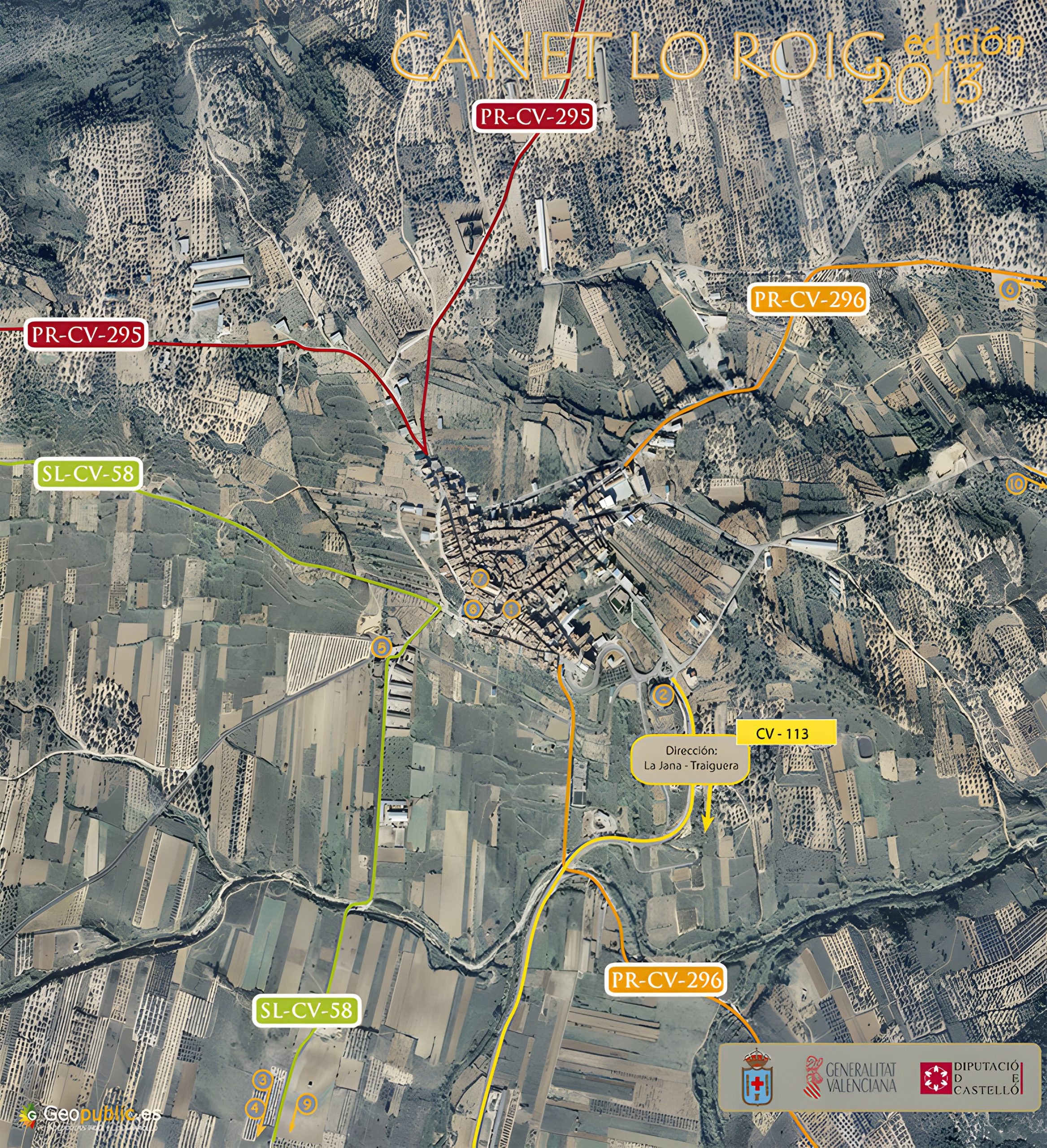
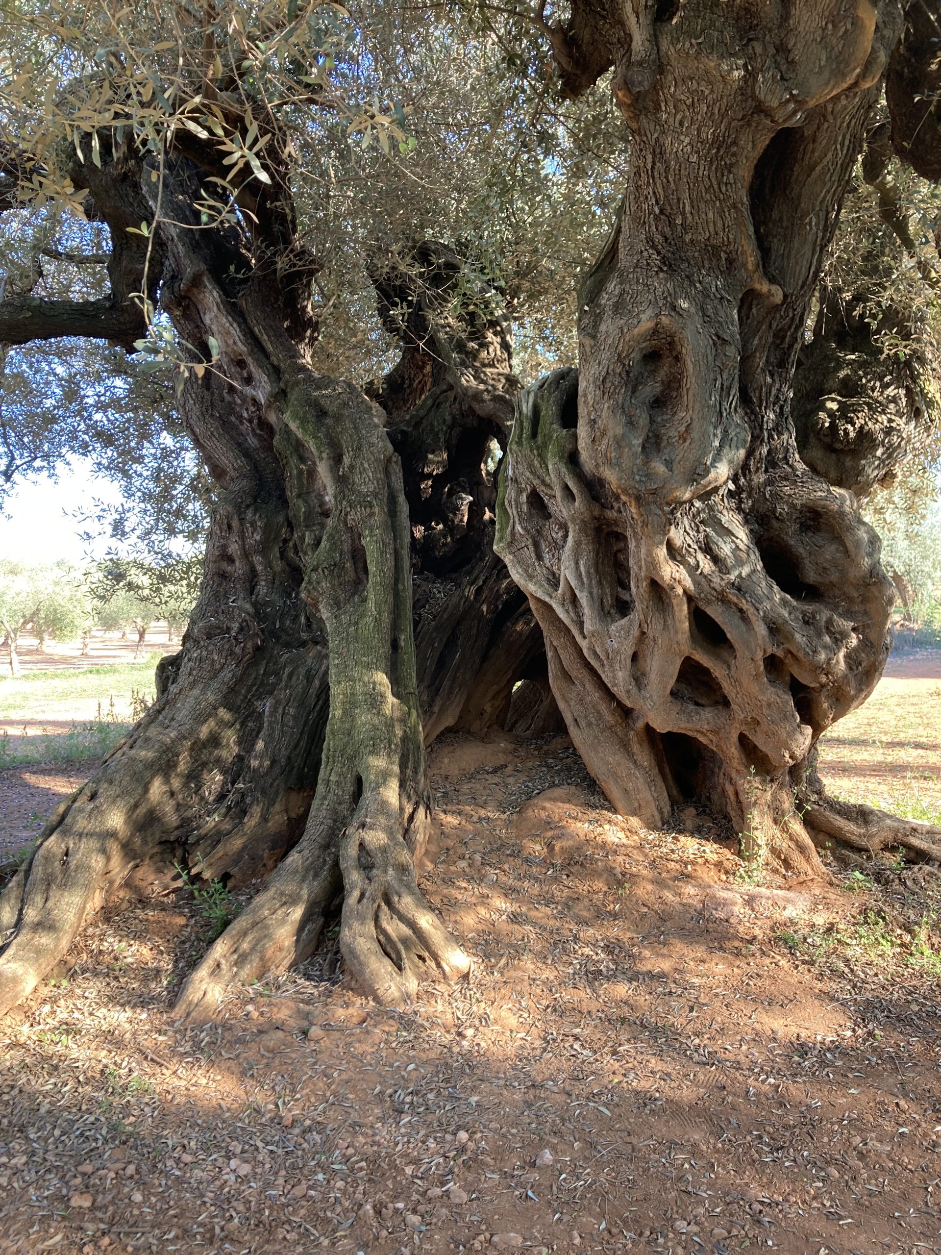
The route through the ancient olive trees (SL-CV-58)
- DISTANCE: 5.8 km
- SLOPE: 60 m
- WALKING TIME: 1 h 30 min
Throughout the municipality of Canet lo Roig there are olive trees that have been planted and over time have become monumental trees of exceptional beauty and more than two thousand years old.
Olive oil, which has been present in the region since Roman times, was born from the fruit of the olive tree, which has been used, in addition to food, as ointment, medicine, cosmetics and for religious rituals. The olive trees that provided oil to the inhabitants of these places in Roman times, now provide this element to the inhabitants of the present.
The Cervol river and its mills (PR-CV-295)
- DISTANCE: 14.6 km
- SLOPE: 168 m
- WALKING TIME: 4h
The Cervol river has a length of 59 km. Its source is located in Cap De Riu, east of Morella. On the way to its mouth, in the Mediterranean Sea, it crosses the municipalities of Vallibona, Rossell, Canet lo Roig, Traiguera, Sant Jordi and Vinarós. During most of the year they remain dry, except for some points with fountains and springs that cause water to surface. The existence of springs like the one at Mas del Coll, makes the presence of water around these points possible. These waters accumulate in pools such as Les Cadenes and Les Vaques. These pools are located in some places where water erosion has shaped the rock, giving rise to formations where water can almost always be found.
Sierra de Sant Pere (PR-CV-296)
- DISTANCE: 13 km
- SLOPE: 315 m
- WALKING TIME: 4 h 30 min
La Serra de Sant Pere está situada al sur de Canet lo Roig. Se trata de una sierrra paralela a la costa, que forma parte de las estribaciones de Maestat. Su punto más elevado es la Ermita de Sant Pere, con 542 m de altitud. En la sierra confluyen los términos de Canet lo Roig, Traiguera y la Jana. Durante el recorrdo pueden verse los mojones correspondientes. Desde la ermita se ve la planta de Vinarós, las sierras de Montsià y Godall, la Foia de Ulldecona, la plana de La Galera, els Ports, la Tinença de Benifassà, el Turmell, las Moles de Xert y la serra d’irta. A su verz, se ven también algunos pueblos como Canet lo Roig, Rossell, la Sénia, Alcanar, Vinaròs, Benicarló, Peñíscola, Traiguera, la Jana, Sant Mateu, Ulldecona y Xert.